Stern Grove to Presidio via Twin Peaks, Mt Sutro and Golden Gate Park (reroute):
6.6 miles one-way; car shuttle possible
From: Wawona Street at 20th Avenue
To: Arguello Gate
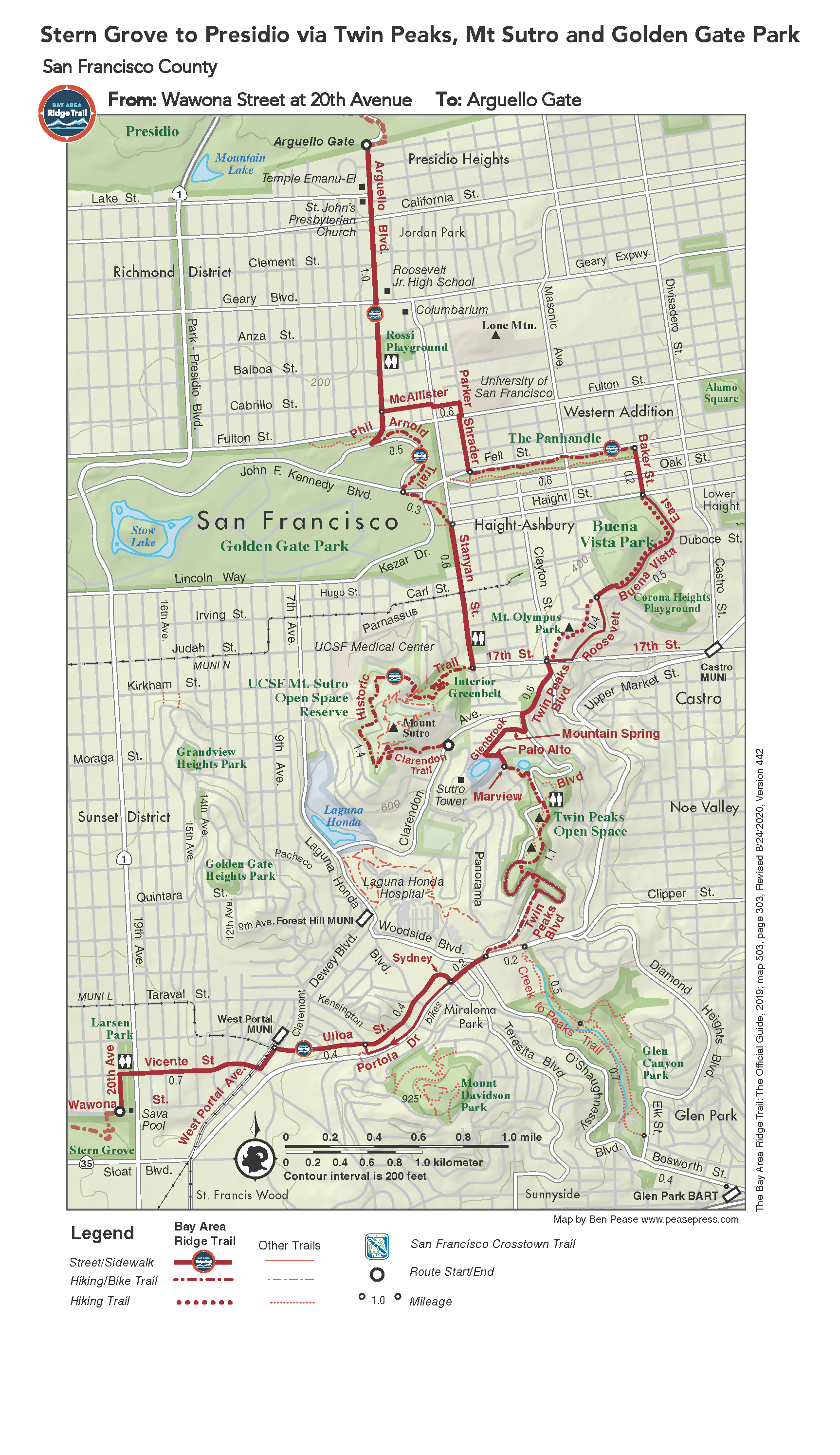
San Francisco’s spectacular bay and ocean views reward you on gradual climbs along city streets and park paths. Visit a number of parks, playgrounds, and unique residential and commercial neighborhoods. The route takes you near Twin Peaks and Sutro Tower, and through Buena Vista Park and the Panhandle. Be prepared for San Francisco’s foggy and breezy weather.
*Detour currently in place on Mount Sutro. Click here for a map and more information.
Elevation Gain/Loss 920 feet/875 feet one-way
OuterSpatial Mobile Map: Click Here
Must have the OuterSpatial app for the link to take you directly to the mobile map page.
This trail description is excerpted from the 2019 Guidebook. For details on all trails, trailheads and more buy the book from Wilderness Press.
For more resources to plan your trip, visit our Trail Tools page.