Sanborn County Park and Castle Rock State Park:
6 miles one-way; car shuttle possible
From: Sunnyvale Mountain Staging Area
To: Saratoga Gap in Saratoga
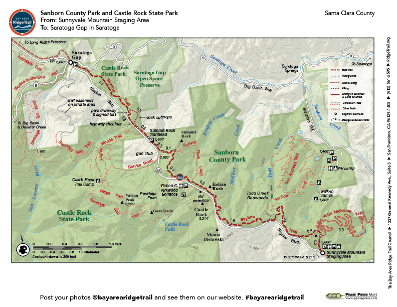
Follow the Skyline Trail along the wooded ridgeline of two vast parks: Sanborn County Park and Castle Rock State Park. On the route of old Summit Road, you wind along the protected east side of the crest of the Santa Cruz Mountains through forests of Douglas-fir, oak, and madrone; you pass immense sandstone outcrops and vestiges of early homesteaders’ orchards and dwellings. This fairly level trip, entirely in shade, is ideal for warm days.
Elevation Gain/Loss 560 feet/850 feet one-way
OuterSpatial Mobile Map: Click Here
Must have the OuterSpatial app for the link to take you directly to the mobile map page.
This trail description is excerpted from the 2019 Guidebook. For details on all trails, trailheads and more buy the book from Wilderness Press.
For more resources to plan your trip, visit our Trail Tools page.