Almaden Quicksilver County Park:
4.6 miles one-way; car shuttle possible
From: Mockingbird Hill Trailhead
To: Jacques Ridge Parking Area in San José
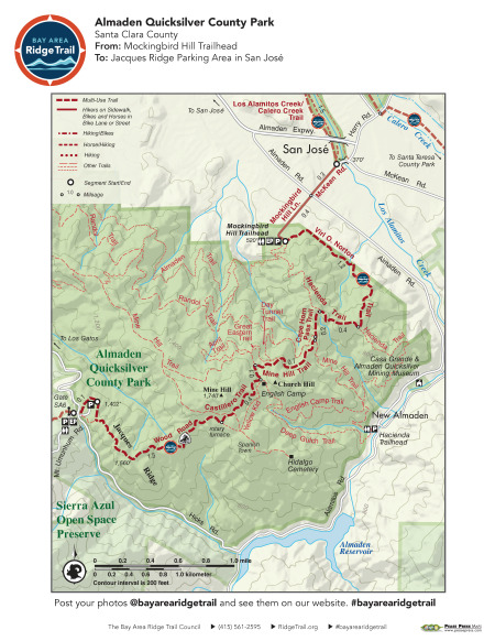
A steady climb to the slopes of Mount Umunhum takes you through a beautiful landscape once actively mined for quicksilver. The Ridge Trail follows old mining roads over these hills, where you can imagine New Almaden Mine’s heyday. Historic buildings and interpretive panels tell the story of the community that once occupied these hills. Superb views look out over the Santa Clara Valley and Santa Cruz Mountains. Much of this route is exposed and can be hot in summer; plan accordingly.
Elevation Gain/Loss 1,160 feet/345 feet one-way
OuterSpatial Mobile Map: Click Here
Must have the OuterSpatial app for the link to take you directly to the mobile map page.
This trail description is excerpted from the 2019 Guidebook. For details on all trails, trailheads and more buy the book from Wilderness Press.
For more resources to plan your trip, visit our Trip Planning Tools page.