Windy Hill Open Space Preserve:
3.3 miles one-way for hikers, 3.1 miles one-way for equestrians, 0.5 miles one-way for mountain bikers; car shuttle possible
From: Upper Razorback Ridge Trailhead
To: Spring Ridge Trailhead in Portola Valley
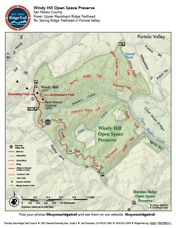
Follow the Windy Hill ridgeline through a sheltered forest and across rolling grasslands on a narrow footpath and broad wagon road. Enjoy sweeping views of the San Mateo Coast and Santa Clara Valley. True to its name, strong winds are possible in this preserve, as is coastal fog. Since this is a relatively short trip, hikers and equestrians may want to do the 6.6- or 6.2-mile round-trip. Bicycles are only allowed on a short 0.5-mile section.
Bikers restricted to a short section.
Elevation Gain/Loss 420 feet/550 feet one-way
OuterSpatial Mobile Map: Click Here
Must have the OuterSpatial app for the link to take you directly to the mobile map page.
This trail description is excerpted from the 2019 Guidebook. For details on all trails, trailheads and more buy the book from Wilderness Press.
For more resources to plan your trip, visit our Trail Tools page.