Lynch Canyon Open Space to Hiddenbrook Open Space via McGary Road:
Lynch Canyon segment, 4.3 miles one-way (plus 4.3-mile return to trailhead); McGary Road segment, 3.5 miles one-way
From: Redtop Road in Fairfield
To: Hiddenbrooke Parkway in Vallejo
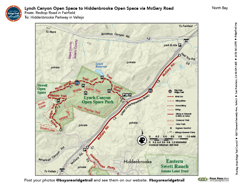
The trail in Lynch Canyon climbs and descends a series of grassy hilltops, and offers stunning 360-degree views. An ideal time to visit is the spring, when dazzling arrays of wildflowers cover the hillsides and the creeks run full. A distinctive feature along the spine of the preserve is a loose aggregation of irregularly shaped rocks graced by wind-sculpted live oak and bay trees. The McGary Road segment is a bike lane that begins at Red Top Road, connecting to Lynch Canyon and the Hiddenbrooke Trail.
Open Hours: Friday through Monday, 9am to 5pm.
For more information about accessing Lynch Canyon, visit the Solano County Website or the Solano Land Trust Website.
Elevation Gain/Loss 665 feet/150 feet one-way (Lynch Canyon segment); 295-foot gain (McGary Road segment)
This trail description is excerpted from the 2019 Guidebook. For details on all trails, trailheads and more buy the book from Wilderness Press.
For more resources to plan your trip, visit our Trail Tools page.