Don Castro and Five Canyons Parkway to Garin or Dry Creek Regional Parks:
10.6 or 11.2 miles one-way (includes a 0.2-mile connector on northern end and a 2.9- or 3.5-mile connector on southern end); car shuttle possible
From: Five Canyons Parkway in Castro Valley
To: Garin Regional Park in Hayward or Dry Creek Pioneer Regional Park in Union City
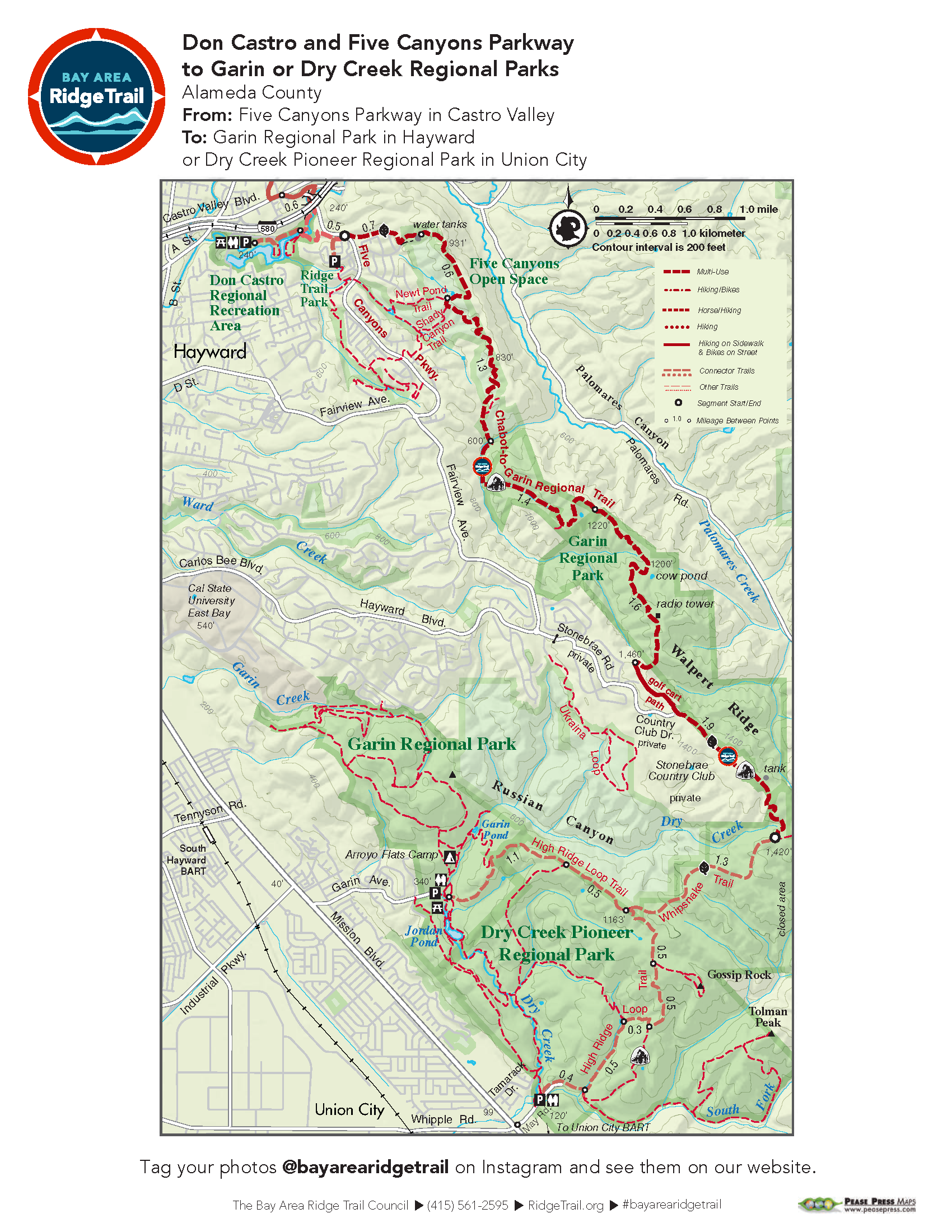
This long stretch of trail is primarily on old ranch roads along the main ridge above Castro Valley, Hayward, and Union City. Mostly on open grassland, the trail offers unparalleled views of the bay and its surrounding mountains, as well as views out to the east. This section is best done as a car shuttle as it is about 11 miles one-way. Two miles of the trail’s midsection pass through the Stonebrae Country Club on golf paths and roads. Because Stonebrae is a gated housing development, it cannot serve as a trailhead for the general public.
Elevation Gain/Loss 1,470 feet/1,520 feet to Garin or 1,470 feet/1,875 feet to Dry Creek
OuterSpatial Mobile Maps:
Don Castro and Five Canyons Parkway to Garin or Dry Creek Regional Parks route
Stonebrae bike route: The Dry Creek/5 Canyons/Garin Loop
Must have the OuterSpatial app for the link to take you directly to the mobile map page.
This trail description is excerpted from the 2019 Guidebook. For details on all trails, trailheads and more buy the book from Wilderness Press.
For more resources to plan your trip, visit our Trail Tools page.